10 Insane Crimes That Happened in Diners 4.7k views
Since the inception of Google Earth in 2005, it has done more than just turning the large globes into desk decor. As soon as Google Earth hit the web, it opened the doors to each and every corner of the world. With just a single click, you can explore any corner of the world from the comfort of your home. Apart from this, there have been numerous amazing Google Earth discoveries.
But it’s not just a neat toy; some extraordinary things have been discovered with its one-click access to satellite imagery.

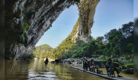
Jay H. Wilbur, an arch enthusiast, was going through Google Earth when he happened upon something in China that looked like a giant natural bridge. Wilbur is a founding member of the Natural Arch and Bridge Society (NABS), and his expert eyes immediately recognized the structure as a natural bridge. Moreover, there was a Panoramio image by Ivanytng, a Chinese photographer, that confirmed the arch enthusiast’s speculation.
In 2010, a seven-person team of the NABS visited the area where the structure was located and took measurements. The measurements amazed them. The bridge has a span of 400 ± 15 feet with a height of more than 200 feet. This clearly made the newly discovered structure the largest natural bridge on Earth. Prior to this, the largest bridge was the Landscape Arch in Arches National Park, United States, with a span of just 290 feet. This amazing creation of nature was likely to have remained hidden if it was not for Google Earth. (source)

In December 2010, there was outrage among Iranian officials as the result of a discovery of a Zionist symbol. The Star of David was etched on the rooftop of Iran’s largest airport. Apparently, the discovery was made via Google Earth. Officials in Iran called for the immediate removal of the Zionist community symbol as soon as they learned about it.
Even though it has been more than 30 years since Iran and Israel broke ties, the airport building was constructed by Israeli engineers prior to the 1979 Islamic Revolution. That is presumed to be the explanation for the presence of the symbol. (source)
It’s surprising that there are still places on Earth that are untouched by any civilization. One such place lies deep within the forests of Mozambique. It is a mountain that was discovered by scientists in 2005. Prior to this, only the locals had the knowledge of this mountain.
The mountain was discovered by Julian Bayliss, a biologist at the Kew Royal Botanical Gardens. Bayliss often used Google Earth to uncover new biodiversity hotspots across Africa that were not previously known. Upon the discovery, an international team of 28 scientists, under the leadership of Bayliss, went on their first expedition to the mountain in 2008.
The amazing part about this discovery is that this particular mountain, Mount Mabu, is the home of the largest medium-altitude rainforest in all of the southern part of Africa. Also, the biodiversity is phenomenal. The team of scientists discovered a rare orchid and a parasitic shrub, Helixanthera schizocalyx, that is hairless and grows by attaching itself to plant branches. In all, they collected more than 500 plant specimens for study.
Scientists discovered not only plants but also many new animal and insect species. They found about 200 different species of butterflies. Mount Mabu also houses many endangered birds, with one of them being the vulnerable Swynnerton robin. The Thyolo Alethe, a bird that is endangered elsewhere, is also found all around the forest. In total, 126 bird species were identified on the mountain, with six of them being vulnerable globally. They discovered multiple species that were altogether new to science. (source)

In January 2017, a mysterious oval-shaped structure was seen using Google Earth over Antarctica. It is believed to be spanning across an area of 400 feet. Scientists initially thought the structure to be a sastrugi, a natural phenomenon that is formed by years of pounding by strong cold winds and heavy snowfall. But sastrugis are never known to form an oval shape like the structure seen using Google Earth.
Ashoka Tripathi, an archaeologist with the Department of Archaeology at the University of Calcutta, believes that this structure may have been man-made and could offer evidence of some ancient civilization. Maybe Antarctica was home to an ancient civilization that was wiped from the face of the Earth and we had no evidence of it until now.
This is not the first time when images from the Antarctic have raised speculations on the existence of human civilizations. Earlier, images released by NASA from their ice-mapping mission, IceBridge, showed some pyramid-shaped structures that were clearly not natural formations. Scientists are still working on identifying the source and cause of such structures discovered across Antarctica. (source)

There is a disputed border region between India and China known as Aksai Chin. It is claimed by China as part of Hotan Prefecture of Xinjiang Autonomous Region and also by India as part of the Ladakh region. Both the countries fought a war in 1962 in Aksai Chin and Arunachal Pradesh over the ownership of the area, but in 1993 and 1996, they signed agreements to respect the Line of Actual Control.
In 2006, some Google Earth spotters noticed a man-made structure at a remote location in China that resembled the Aksai Chin. The structure has been built to scale within a large military complex and is incorporated with man-made snow peaks, freezing lakes and snow rifts even though it is in the middle of an arid plain.
When approached by the media, the military did not confirm its knowledge of the structure. They just said that it is not uncommon for militaries to devise simulations of conflict regions for training purposes. Many believe that in spite of the peace dialogues between the two countries, the PLA is still keeping its forces in touch with the conflict zones. (source)